Physical Address
Suite 5, 181 High Street,
Willoughby North NSW 2068
Physical Address
Suite 5, 181 High Street,
Willoughby North NSW 2068
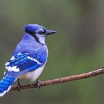
Almost everyone watches clouds, among the most fascinating and easily observed of all weather phenomena. Clouds form through the process of condensation when water vapor, primarily from the oceans, rises into the atmosphere where it cools and condenses into cloud formations. If the condensed droplets in a cloud get large enough, they’ll fall as precipitation. Rain clouds, or nimbus, produce everything from drizzle to downpours; more violent relatives of theirs may unleash rain as part of intense thunderstorms.
Rain or “nimbus” clouds may appear as low, sheeted “stratonimbus” producing sprinkles or steady drizzle or as tall “cumulonimbus” clattering with thunder and flashing with lightning. The cumulonimbus’s forerunner, cumulus congestus, may also drop rain.
Nimbus is an ancient Latin word meaning “rain storm.” Rain or nimbus clouds tend to appear dark gray because their depth and/or density of large water droplets obscures sunlight. Depending on temperature, nimbus clouds may precipitate hail or snow instead of liquid rain.
The prefix “nimbo-” or the suffix “-nimbus” designate two prominent kinds of rain clouds, “nimbostratus” and “cumulonimbus,” although rain sometimes falls from other cloud varieties.
Understanding the two major varieties of rain cloud means knowing the basics of how meteorologists classify clouds. Besides being identified as precipitating nimbus or not, clouds are classified by their appearance – layered (“stratus”), heaped (“cumulus”) or a combination thereof – and by their altitude. Low-altitude clouds include stratus, cumulus and stratocumulus clouds. Mid-level clouds are designated with a prefix of “alto-” and include altocumulus and altostratus clouds. The highest altitude clouds, which appear wispy and feathery, are called cirrus clouds and include cirrocumulus, cirrostratus and cirrus clouds.
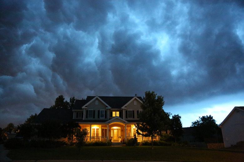
When the atmosphere is unstable enough to allow for significant vertical growth of a cumulus cloud, precipitation may result. Towering cumulus, or cumulus congestus, may generate rain; they may also develop into the even larger, more energetic cumulonimbus. Cumulonimbus clouds, sometimes called “thunderheads,” are associated with thunderstorms, lightning and intense, heavy rains as well as hail. Cumulonimbus clouds grow vertically and commonly adopt an anvil shape, with a low, dark base often only 1,000 feet above ground and tops reaching up to 50,000 feet into the atmosphere.
Cumulonimbus clouds carry a mass of unstable air and often produce unpredictable high winds and downdrafts. These clouds are capable of generating violent supercell storms, tornadoes and dangerous wind-shear conditions.
When you look to the sky on a rainy day and see nothing but a dense blanket of low, gray, featureless clouds, you are looking at nimbostratus. These clouds form at low or middle altitudes and block sunlight. In contrast with the intense, short-lived rains associated with unstable cumulonimbus clouds, nimbostratus clouds typically produce light or moderate rainfall of longer duration.
Because nimbostratus clouds form with their bases below 6,500 feet, they normally contain water droplets, but can contain snow or ice if temperatures are low enough.